On a Saturday in spring, New York’s High Line Park can be a bit like its subway system at rush hour: locals push past groups of Italian tourists, couples compete for limited seating and the crush of people at the exits can feel like pouring syrup through a funnel.
Despite the crowds, walking the High Line is a genuine thrill. The former elevated rail line winds its way ten blocks through the meatpacking district and Chelsea, around new artfully designed condos and old tenements, ending with a view of the West Side Rail Yards and the Hudson River. It’s a rainforest canopy walk in the city, a perfect solution to a lack of public space in crowded Manhattan and a showcase for exuberant public art and design.
It’s probably the single biggest tourist attraction that New York has added recently, spurring development and boosting retail sales in the neighbourhoods it touches. It’s a rare public project that has managed to please just about everyone. Not surprisingly, many Canadian cities and public space advocates are looking for ways to emulate it.
In Toronto there’s long been a movement to convert the Gardiner Expressway, the traffic choked elevated thoroughfare that divides the city from its lakefront, into something greener. But unlike the High Line, the Gardiner is a major route for people driving into the city and doing away with it is a tough political sell. There’s been a number of proposals, however, to cover or disguise it including one called the Green Ribbon that would add an upper deck covered in greenery and recreational space much like the High Line.
In Vancouver, however, the repeated proposals to turn the city’s downtown Georgia and Dunsmuir viaducts into a High Line-like elevated park seem to be gaining traction. Unlike Toronto, there’s a lot of momentum here as politicians, architects and city planners have endorsed a plan to revamp the eastern edge of False Creek — a desolate area of undeveloped land traversed by the viaducts — into a community that would tie together key downtown neighbourhoods.
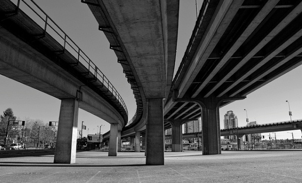
The viaducts are the remnants of a regional freeway plan that was thwarted in the seventies by residents who feared the destruction of their neighbourhoods. They’ve been getting fewer drivers than they used to while the wide roads beneath them make them less than essential arteries. During the 2010 Olympics, the viaducts were closed for the first time allowing residents on the eastern side of downtown to breathe easily as traffic was diverted elsewhere.
After this, Councillor Geoff Meggs pushed for a planning review resulting in a public contest to generate ideas for the area’s redevelopment including the viaducts. One of the most exciting ideas was from the city’s former head of planning Larry Beasley and the late city councillor Jim Green. This plan would demolish much of the existing structure to make room for housing and public space while leaving a High Line-like section that elegantly splits the city’s two main sports arenas and provides compelling views of the city and the mountains beyond.
With Vancouver’s stunning natural beauty and the overwhelming success of New York’s High Line as a guide Canada might soon have its very own piece of elevated repurposed public space to enjoy.
——————–
Image courtesy of .mused.

Pluheeezz…the Gardiner does NOT cut the city off from the waterfront. The wall of apartments, condos and hotels DOES!